
In this section: Culture
Ukraine: an introduction
Where Ukraine is, what its land looks like from the Carpathians to the Black Sea, how its regions differ, and which languages people speak, with a few Ukrainian words for places and directions.
On this page
Ukraine (Украї́на) is a large country in eastern Europe, on the northern coast of the Black Sea. Its capital is Kyiv, and its state language is Ukrainian. If you are learning the language, this page gives you the map behind the words: where the country is, what its land looks like, and how its regions differ from one another.
Where Ukraine is
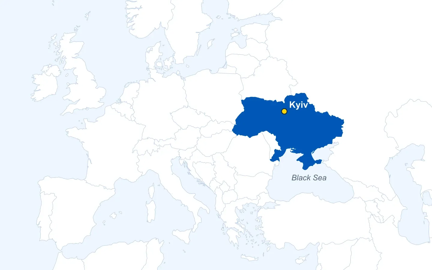
Ukraine has seven neighbours. Belarus lies to the north and Russia to the north-east and east. Moldova and Romania are to the south-west, and Hungary, Slovakia and Poland to the west. To the south are the Black Sea and the Sea of Azov.
With an area of about 604,000 km² (roughly 233,000 square miles), including Crimea, Ukraine is one of the largest countries in Europe.
Borders and control
Ukraine’s internationally recognised borders include Crimea and the whole of the Donetsk, Luhansk, Zaporizhzhia and Kherson regions. The UN General Assembly affirmed them in 2014 and reaffirmed them in 2022, when it also called on all states not to recognise Russia’s attempted annexation of the four regions. Russia occupied Crimea and parts of the Donetsk and Luhansk regions in 2014, and much larger areas of the east and south after its full-scale invasion in February 2022. The line of control has moved during the war, so the map above shows the recognised borders, not where the front runs.
The land
Most of Ukraine is flat or gently rolling. Mountains appear in only two places: the Carpathians in the far west, and the Crimean Mountains in the south of Crimea.
From north to south the landscape changes in broad bands. In the north-west there is forest. Further south comes the forest-steppe, a mix of woodland and open land. The south and east are steppe, the natural grassland of the region, on very fertile black soil called chornozem. Most of that land has long been farmed, and wheat is its main grain.
The climate is temperate. Winters get harsher the further east you go, and the land gets drier towards the south. On the Black Sea shore, in the far south, the climate and the plants come close to those of the Mediterranean.
The Carpathians
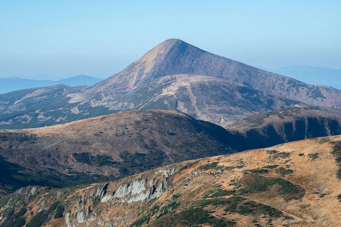
The Carpathians are a long arc of mountains, about 1,500 km from end to end, shared by several countries. The Ukrainian part lies in the west. Its highest peak, Гове́рла (Hoverla, 2,061 m), is also the highest point in Ukraine. The river Prut rises on its slopes.

The Dnipro
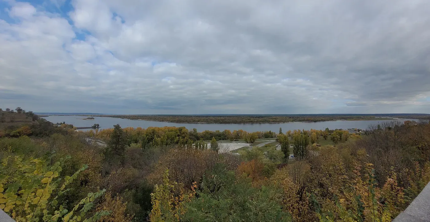
The Dnipro (Дніпро́; older English books call it the Dnieper) is the largest river in Ukraine. It comes from Russia and Belarus and then flows south through the middle of the country, crossing the forest, the forest-steppe and the steppe, until it reaches the Black Sea. Kyiv stands on its banks.

Kyiv and the regions
Kyiv (Ки́їв) is the capital and the largest city. For government, the country is divided into 24 regions called oblasts (о́бласть), the Autonomous Republic of Crimea, and two cities with special status, Kyiv and Sevastopol.
People also use older names for historical regions, which don’t always match the oblast borders. You will meet them in books, songs and conversation:
- Galicia, with Lviv as its historic capital
- Volhynia, in the north-west
- Transcarpathia, the westernmost region, beyond the Carpathians
- Bukovyna, Podillia and Polissia
- Slobidska Ukraine, around Kharkiv
- the Donbas and Crimea
These regions have different histories. Until the 20th century, different parts of today’s Ukraine often belonged to different states: Lviv, for example, was part of the Kingdom of Poland until 1772 and then of Austria until 1918. The regions still differ in landscape, history and the language people speak at home (see below). That is a more useful way to see them than a simple split into “east” and “west”.
Languages
Ukrainian is the state language. The Constitution also guarantees the free development and use of Russian and the other languages of national minorities.
What people speak at home is a different question, and the answer varies by region and has changed over time. In the 2001 census, 67.5% of people named Ukrainian as their mother tongue, 29.6% Russian and 2.9% another language. Smaller communities speak Crimean Tatar, Hungarian, Romanian, Bulgarian, Polish, Greek and other languages.
A newer picture comes from a telephone survey of 1,029 adults by the Kyiv International Institute of Sociology in February and March 2025. In it, 63% said they usually speak Ukrainian at home, 13% Russian, and 19% both equally; in 2020 the figures were 52%, 25% and 18%. In the survey’s western region, 85% spoke Ukrainian at home in both years. In its southern region the share rose from 22% to 39%, and in its eastern region from 17% to 29%. The survey covered only government-controlled territory and did not include people who had left the country after February 2022, and KIIS itself warns that wartime conditions may bias the answers. It is a snapshot, not a census. Many people are at home in both languages.
A short look at history
Ukraine became an independent state on 24 August 1991, when the Supreme Soviet, the parliament of Soviet Ukraine, proclaimed independence. The history before and after it is long, and it will have its own pages in this section.
For Ukrainian place names in English, this site uses the official transliteration: Kyiv, Lviv, Kharkiv. Stress and transliteration explains how it works. To say where you are from, see Introductions.

A little Ukrainian
Words for finding your way around a map of Ukraine. To say where something is, use на with the locative case: на за́ході, in the west.
- Украї́на
- Ukrainefeminine; з Украї́ни, from Ukraine; в Украї́ні, in Ukraine
- столи́ця
- capital (city)feminine
- рі́чка
- riverfeminine; plural річки́
- мо́ре
- seaneuter; Чо́рне мо́ре, the Black Sea; Азо́вське мо́ре, the Sea of Azov
- го́ри
- mountainsplural of гора́, mountain
- пі́вніч, пі́вдень, схід, за́хід
- north, south, east, westна пі́вночі, in the north; на пі́вдні, in the south; на схо́ді, in the east; на за́ході, in the west
Words without a native-speaker recording are read by a computer-generated voice (OpenAI text-to-speech); the written form, with its stress marks, is the reference.
Read about it in Ukrainian
A short text on this topic, with a word list, a translation, audio and questions.
Related learning
Picture credits
- Illustration of a calm countryside, with golden fields, a winding river and sunflowers under a wide sky: made for Blabober with Recraft.
- Map of Europe with Ukraine, including Crimea, in blue in the east of the continent, north of the Black Sea, and a yellow dot marking Kyiv: Map: Blabober, drawn from Natural Earth country outlines, Public domain, file page.
- A bare, pyramid-shaped mountain peak under a pale blue sky, seen across brown and green grassy ridges with patches of low pine: Photo: Nata Mostova, Wikimedia Commons, CC BY-SA 4.0, file page.
- A wide river with low, wooded islands under a grey, cloudy sky, seen from a hillside covered in autumn trees: Photo: Slava0576, Wikimedia Commons, CC BY-SA 4.0, file page.
Sources
- Constitution of Ukraine (official English text) (Verkhovna Rada of Ukraine)
- Ukrainian Soviet Socialist Republic (Internet Encyclopedia of Ukraine, Canadian Institute of Ukrainian Studies)
- Ukraine (National Geographic Kids)
- Geography of Ukraine (physical) (Internet Encyclopedia of Ukraine)
- Hoverlia (Internet Encyclopedia of Ukraine)
- Carpathian Mountains (Internet Encyclopedia of Ukraine)
- Dnipro River (Internet Encyclopedia of Ukraine)
- Steppe (Internet Encyclopedia of Ukraine)
- Kyiv (Internet Encyclopedia of Ukraine)
- Featured topics: the land and regions of Ukraine (Internet Encyclopedia of Ukraine)
- Lviv (Internet Encyclopedia of Ukraine)
- All-Ukrainian population census 2001: linguistic composition of the population (State Statistics Committee of Ukraine)
- Attitude towards teaching Russian in Ukrainian-language schools (press release, 29 April 2025) (Anton Hrushetsky, Kyiv International Institute of Sociology (KIIS))
- Resolution 68/262: Territorial integrity of Ukraine (United Nations General Assembly)
- Resolution ES-11/4: Territorial integrity of Ukraine: defending the principles of the Charter of the United Nations (United Nations General Assembly)
- Donetsk oblast (Internet Encyclopedia of Ukraine)
- Luhansk oblast (Internet Encyclopedia of Ukraine)
- Горох — онлайн-бібліотека словників української мови (Словозміна) (goroh.pp.ua)
Last updated